
Staying Cold with Mixed Conditions – Thursday 14th – Sunday 17th November 2019

Hi all,
It’s going to remain on the colder-than-average side for a few more days before something milder arrives. It’s been a very wet month and we currently stand at 89.4mm. This forecast is tricky to pin down details, all dependant on where areas of low pressure will sit so, as always, look out for updates on Twitter.
For all days in the forecast, if any clear spells appear overnight and towards the morning then some frost and fog is possible.
Thursday: Bright spells with a cold northeasterly wind. Rain won’t be too far away to our southeast but it is not expected to affect us, with the warning from earlier in the week cancelled. Cold. Max 6°C
Friday: Cloudy and cold with showers, which could be wintry above 300M. A fresh breeze. Max 7°C
Weekend: Showery rain at times but some drier spells.
Saturday: It looks like the low pressure to our east will still influence our weather. A cloudy morning with showery rain. The afternoon should tend to become a little drier. A cold northeasterly. Max 7°C
Sunday: Similar day. Showers at times from the north or northeast which could be wintry. Max 7°C
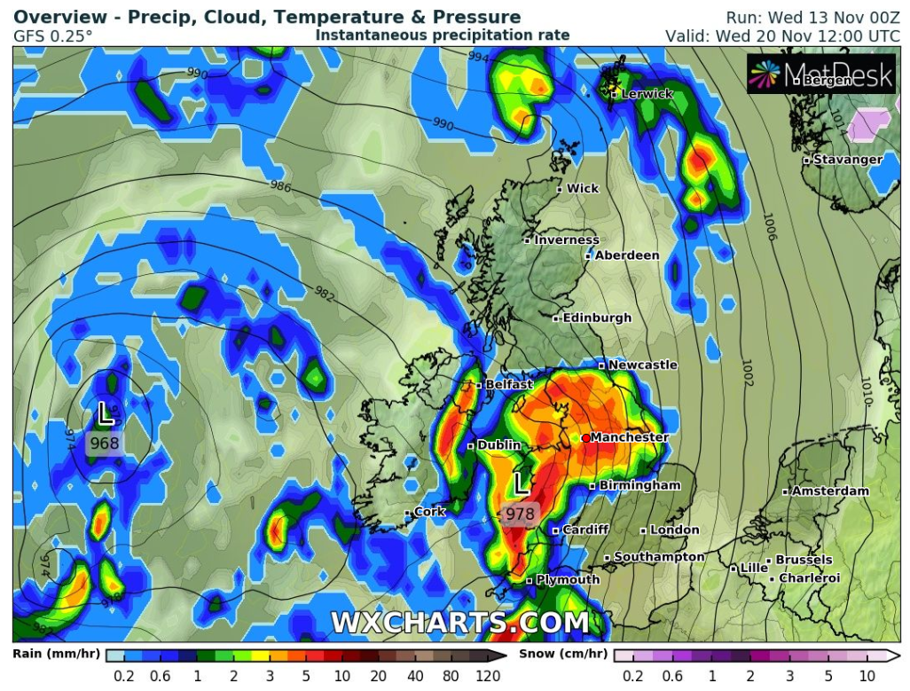
Outlook: Turning milder as areas of low pressure swing up from the southwest with periods of rain.
Follow @ChadWeather on Twitter for the latest forecasts.
Thanks as ever for reading.
Cheers,
Jon
Forecast Issued: Wednesday the 13th of November 2019 at 10am
Image: wxcharts.eu/

Author: Jon Baylis