
Rain returning & less cold – Thursday 21st November 2019 – Sunday 24th November 2019

Hi all,
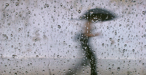
Rain was set to return around midweek but this has been held off by a ridge of high pressure. Although it’s been cold recently, with the coldest night of the autumn so far, it is slowly going to turn slightly milder.
Thursday: The rain will remain away to our southwest, so another dry day with plenty of cloud and a nagging south-easterly breeze making it feel chilly. Max 7°C
Friday: Cloudy with some rain to start, this should clear away northwards around lunchtime leading to a drier and slightly brighter afternoon. A touch milder. Max 9°C
Weekend: Wet Saturday
Saturday: An area of low pressure is going to swing up from the south or southeast and should push a band of rain across the region. There is a little uncertainty on how far northwest this low pressure gets, so this will determine how much rain we see. The day is expected to be cloudy with rain at times, heaviest in the east. It will be slightly milder again. Max 10°C
Sunday: Perhaps some mist or fog to start but it will be frost-free. It will be quite cloudy with some bright spells at times. An Atlantic low is expected to arrive late on Sunday into Monday bringing further rain and milder conditions. Max 10°C
Outlook: Remaining generally unsettled and cloudy with showery rain at times, temperatures around average or slightly above. No sign of any snow on the horizon.
Follow @ChadWeather on Twitter for the very latest forecasts.
Thanks,
Jon
Forecast Issued: Wednesday the 20th of November 2019 at 9:30am

Author: Jon Baylis