Finally the relentless rain stops after tornado hits region. Colder and drier spell incoming – Thursday 4th January 2024 – Sunday 7th January 2024
Hi all,
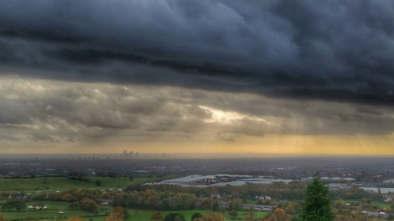
Happy New Year everyone. All the very best for 2024. I hope you had a great Christmas despite the relentless rain. It’s rained for the last 17 days straight, bringing 145.4mm. But, I do have some good news. Much drier weather is on the way and it will also be turning colder. The media has picked up on this and are already talking about snowmageddon {rolls eyes}. For now there is no sign of any significant snow event.
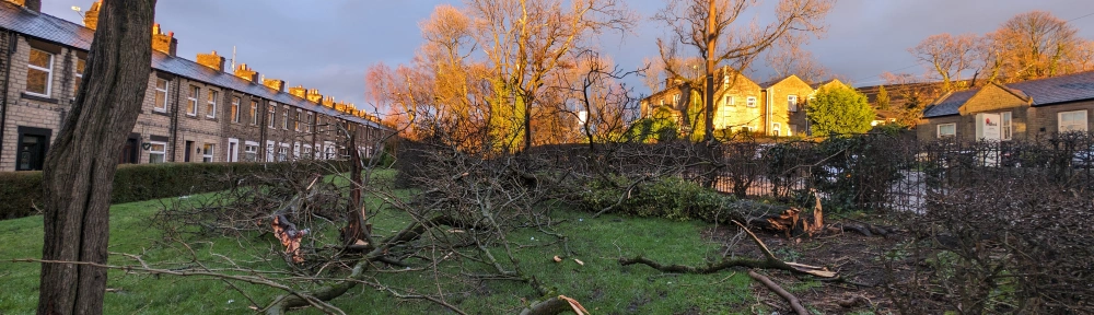
The big talking point since my last blog 2 weeks ago was the tornado that struck parts of Eastern Manchester. Notably, Stalybridge, Copley and Carrbrook. With this location only being around 6 miles away from my house, I did a site investigation for TORRO to plot the damage that I could find and there was a lot. TORRO had already been to the site and initially classed it as a maximum T5 rating which is staggering with estimated wind speeds of 137-160mph. Likely to be the strongest tornado for 17 years (not including the Jersey tornado which was a T6).

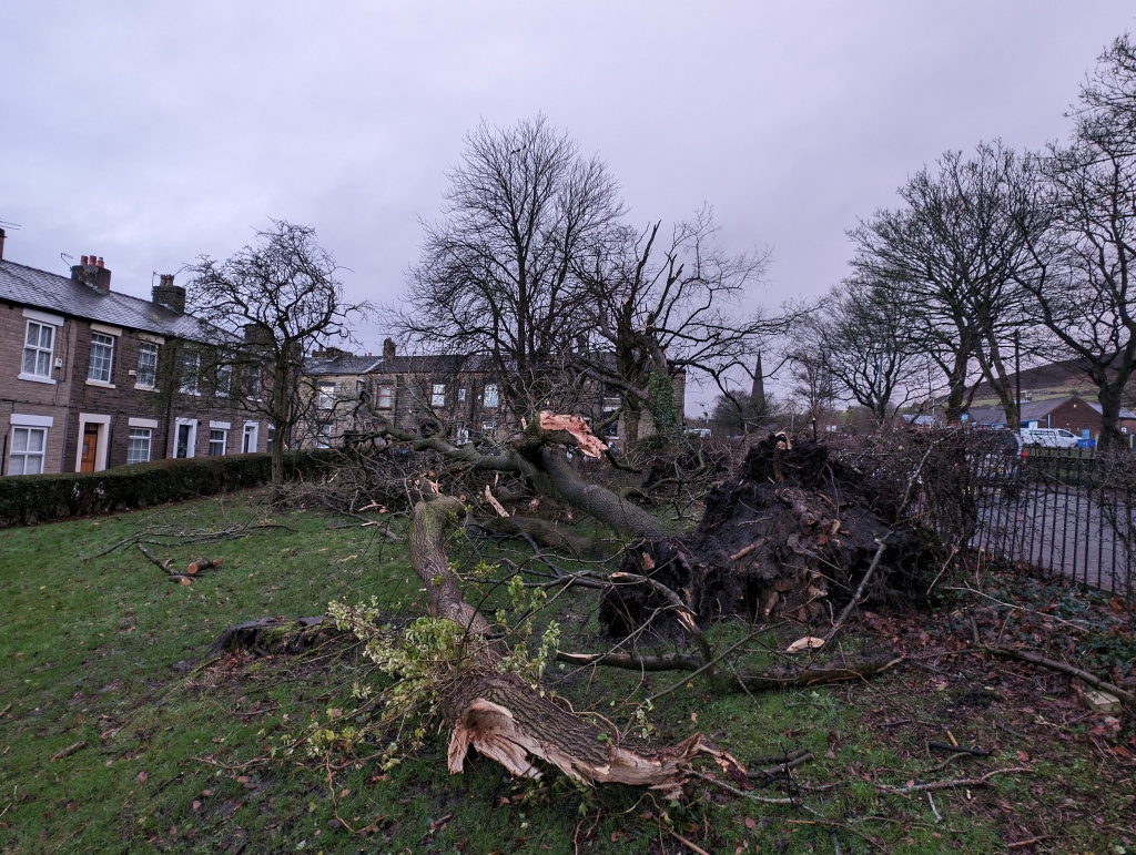

The tornado investigation is still on-going but hopefully it won’t be long before it is finalised.
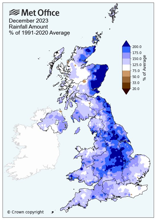
December was a very wet month and mild even after a cold start. In fact the 205mm made it the wettest December I’ve ever recorded in my 12 years of weather records.
There certainly won’t be any tornadoes or wild weather is the near future. High pressure is about to build in across the UK and we will enter a decent 7-10 day spell of mostly, if not completely, dry weather but colder air will accompany this pattern change. Cold enough for snow? Not far off but you need precipitation for that and there won’t be much around. Possible fog would only be the troublesome weather event over the coming days.

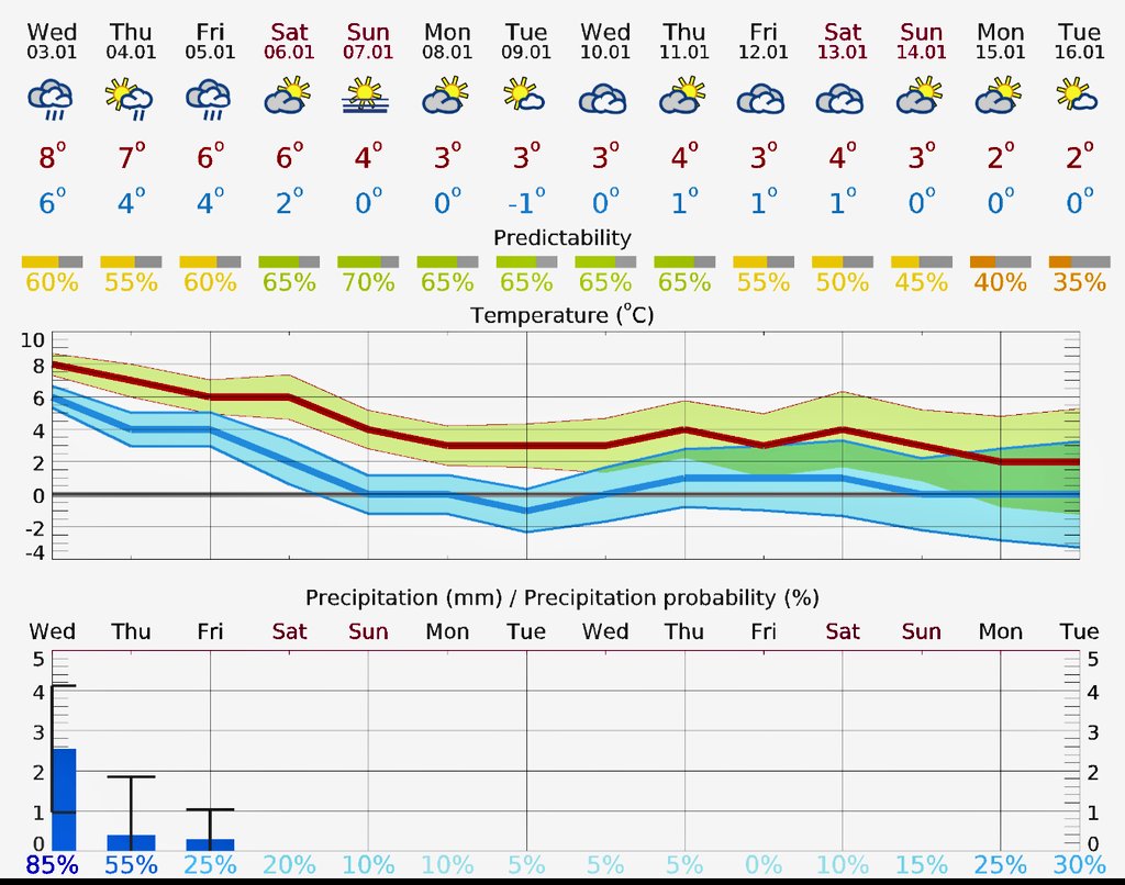
Thursday: A cloudy morning is expected with a few showers. Drier with some bright spells into the afternoon. Winds falling lighter later. Cooler. Max 7°C Min 2°C
Friday: Mostly cloudy and winds will eventually turn north-westerly so it’ll be a little cooler (signs of change). Can’t rule out some showers out towards the west with perhaps the odd one sneaking inland. Max 6°C Min 2°C
Weekend: Drier (yeah!), colder with a risk of fog.
Saturday: A cloudy start with a few bright spells appearing. Chilly. Patchy frost overnight. Winds generally light. Max 5°C Min 1°C
Sunday: Cold setting in now, with mist or fog lifting into low-cloud. Looks like any sunshine will be a rare. Dry with a patchy frost returning overnight with some misty conditions. Max 3°C Min 0°C
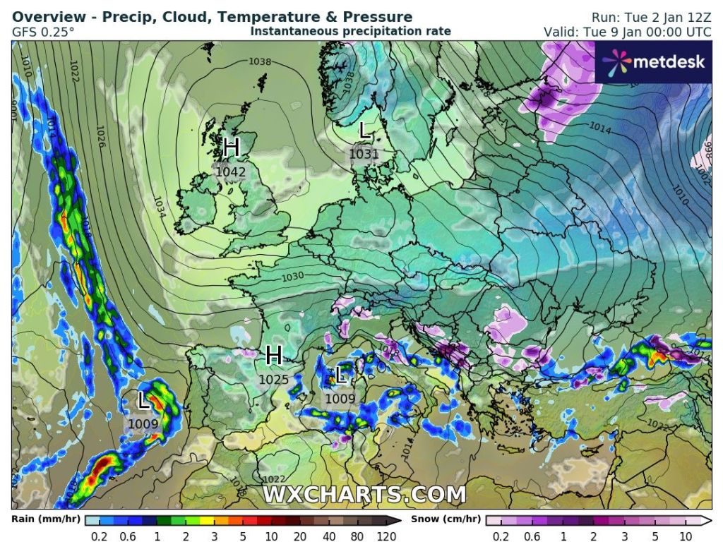
Outlook: A fresh east or north-easterly wind will pick up which will help break up the cloud leading to sunny spells during the day and frosts at night. Looks dry all week. Perhaps snow showers later in the week drifting in from the North Sea and over the Pennines. But, as for now, cold and dry is the order of the week and no significant snow is expected but finally something more seasonal and relief from the deluge.
Follow @ChadWeather on X for the latest forecasts and warnings.
Thanks,
Jon
Forecast Issued: Wednesday the 3rd of January 2024 at 6pm.
Images: TORRO T-Scale, my tornado site investigation, Met Office & www.wxcharts.com.

Author: Jon Baylis