Not exclusively dry but not as wet as recently and turning milder. Chance of a White Christmas – Thursday 14th December 2023 – Sunday 17th December 2023
Hi all,
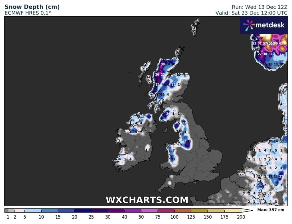
Christmas is coming and of course, the talk of a White Christmas is on everyone’s lips. No doubt you’ll see the over-the-top nonsense in the mainstream media but how are our chances looking, realistically?
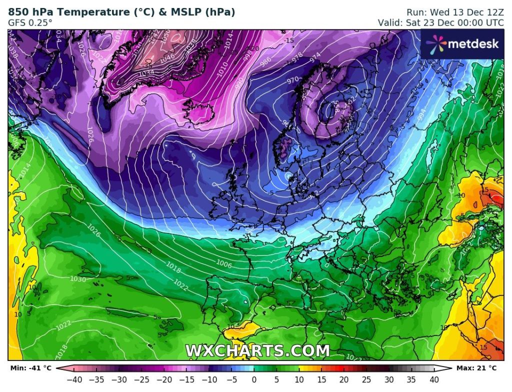
The latter part of this week, will be mild and frosts are not expected. It’s later next week that eyes turn to the north or northwest to the possibility of colder air drifting down across the UK, increasing the chance of some snow. It won’t be severe cold but cold enough for some wintry precipitation. Remember we only need one snowflake to call it a White Christmas officially.
Thursday: Cloudy to start with patchy rain moving west to east. It should become drier and eventually a bit brighter during the morning. Odd shower possible into the afternoon. Less cold. Max 9°C Min 3°C
Friday: Cloudy with a few bright spells here and there. Windy but this wind will be dragging in much milder air as the day goes on. It should be dry at least which is what we need right now. Max 11°C Min 7°C
Weekend: Mostly cloudy with brisk winds.
Saturday: Low pressure to the northwest and high pressure to our south means we will be in between with gusty, moist southwesterly winds. These will bring a lot of cloud, perhaps some hill-drizzle but most areas dry. Mild. Max 12°C Min 7°C
Sunday: Cloudy but dry to start. As the day progresses weather fronts to our northwest will slowly slip southeast bringing the increased risk of some light rain or drizzle. Windy and mild once again. Max 11°C Min 7°C
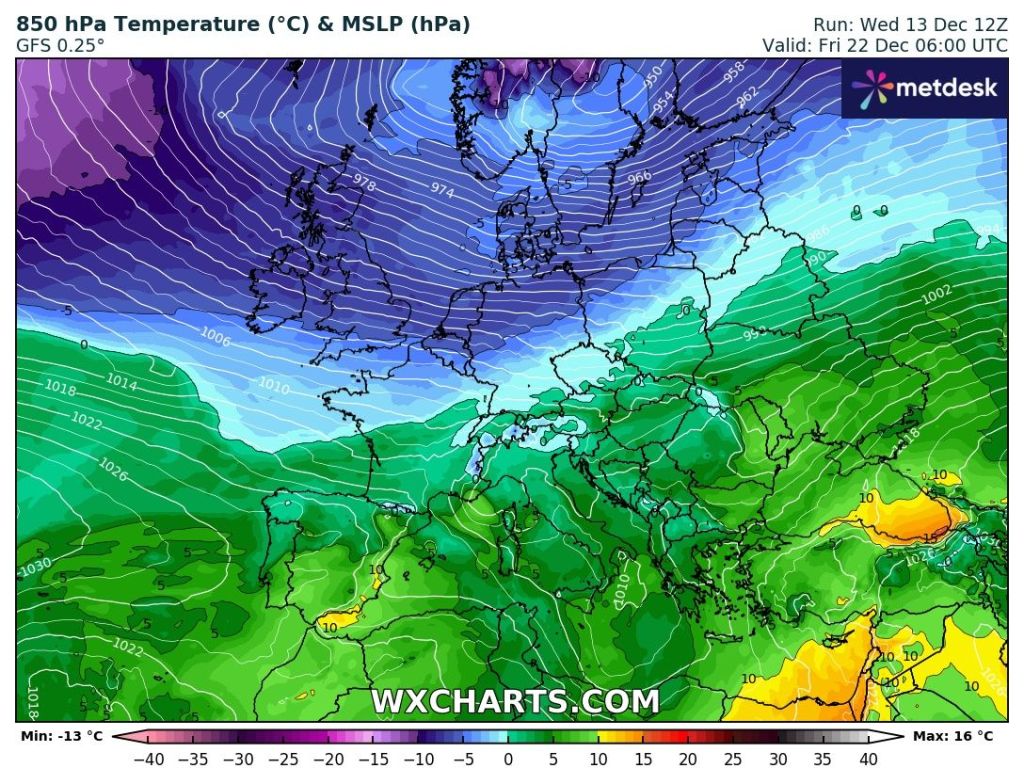
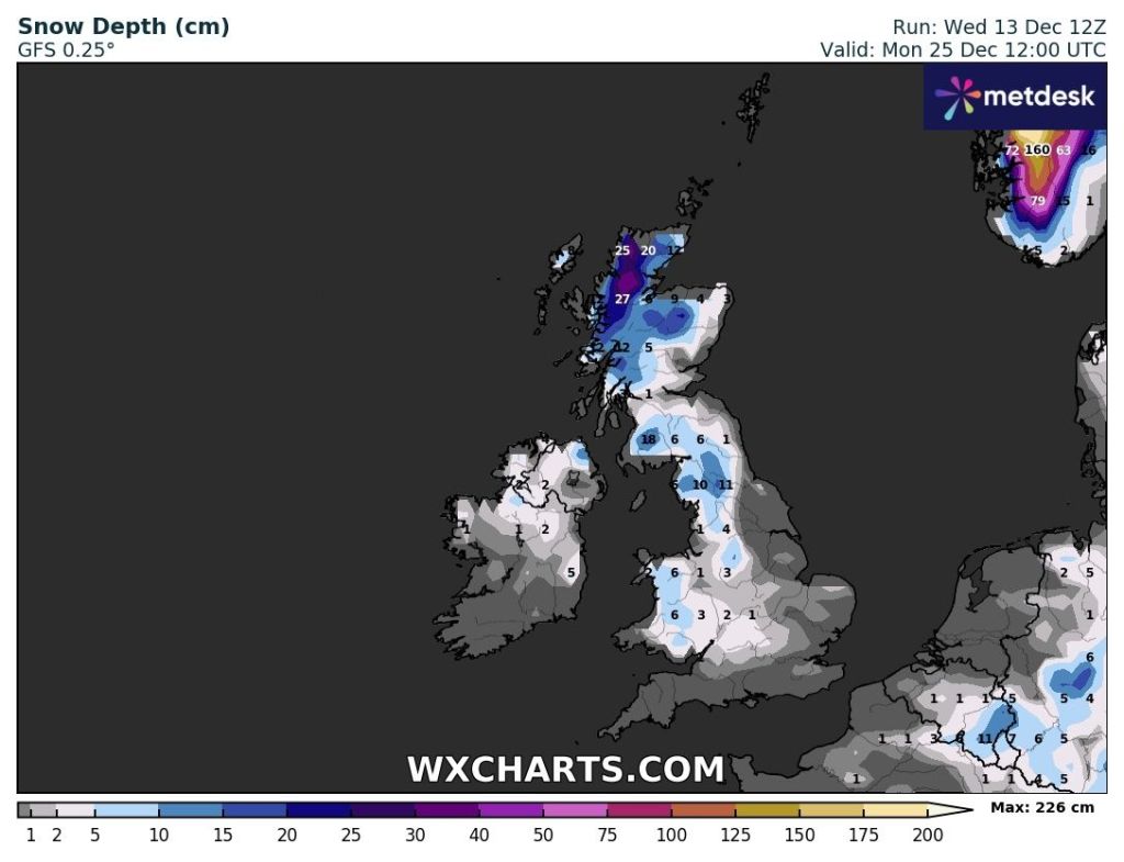
Outlook: We start the week wet and in the mild air still. As the week progresses, and it will be a windy week, the Jet Stream will slip further and further, albeit slowly, south. This will allow cooler and then cold air to slip down from the north or northwest. In the few days leading up to Christmas, wintry showers are likely, so some snow is possible on higher ground. If this lasts until Christmas Day, 2023 could well be officially a White Christmas. Look out for updates on X (@ChadWeather).
Follow @ChadWeather on X for the latest forecasts and warnings.
Thanks,
Jon
Forecast Issued: Wednesday the 13th of December 2023 at 7:30pm
Images: www.wxcharts.com

Author: Jon Baylis