Will the Final Weeks of Summer Deliver? – Thursday 19th August 2021 – Sunday 22nd August 2021
Hi all,
What a dreadful month August is turning out to be. The average maximum temperature for August is 19.5°C. Currently we are sitting at 18.2°C, so much cooler than normal and with limited sunshine. Rainfall is above average so far too but with a drier end to the month looking likely, this figure could well level itself out. Before that, yet more rain to come.
Thursday – A cloudy start with some drizzle/rain. A spell of drier, and hopefully a little brighter for a time, weather either side of lunchtime before showery rain returns into the afternoon. Poor temperatures again. Max 18°C
Friday: A few showers possible early on then a mostly cloudy day once more, with a few bright spells. Temperatures still disappointing for August but signs of it warming up a touch. Max 21°C
Weekend: Becoming unsettled and wet.
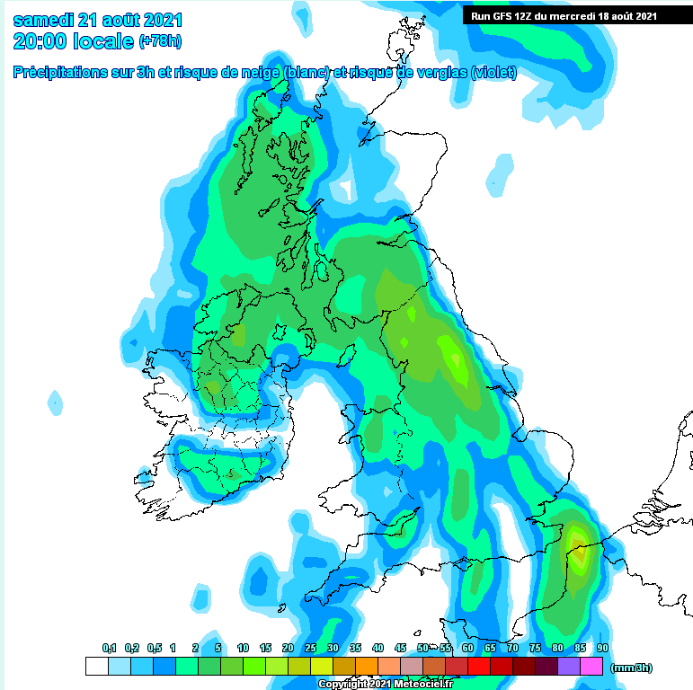
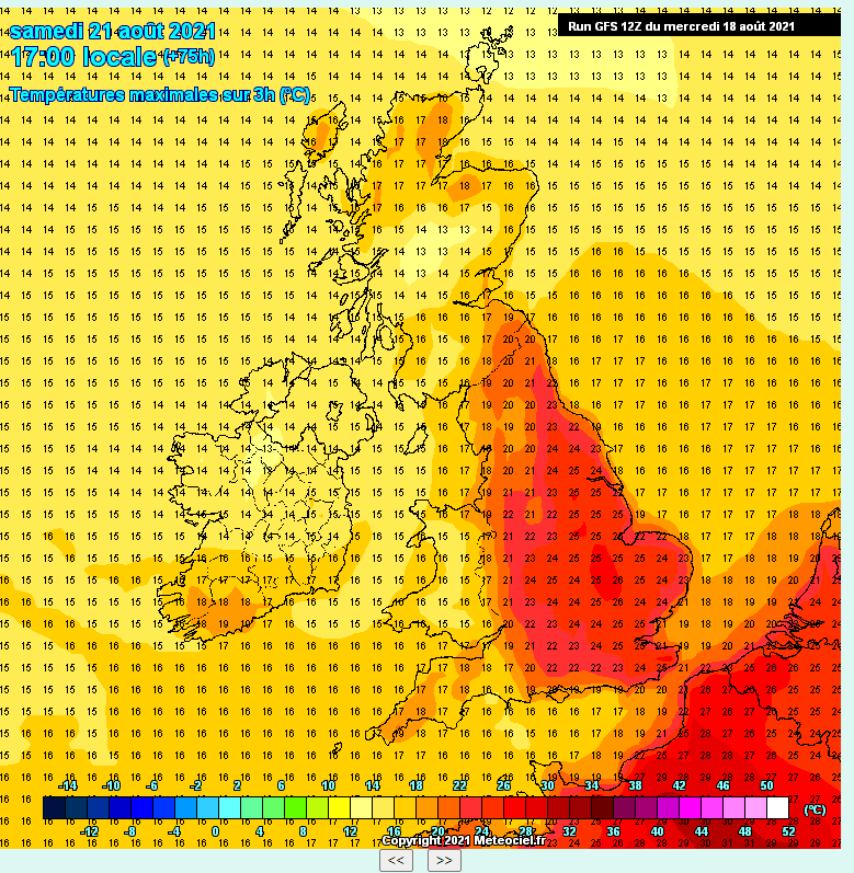
Saturday: We should get away with a mostly dry morning with some warm bright spells as temperatures begin to lift under the influence of a southerly/southeasterly airflow. However, the afternoon looks set to go downhill as showers arrive, some heavy followed by more persistent rain later. Warm and humid. Max 22°C
Sunday: An unsettled day is likely with low pressure in charge. Showers, perhaps thundery with some hail or even longer spells of rain. Slightly cooler but a muggy feel overall. Max 19°C
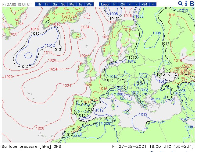
Outlook: Some rain at first, then, this has been trying to happen for a few days/weeks now, high pressure builds in from the northwest and settles our weather down. However, with the air coming in from the northeast/east, temperatures are expected to remain around average with quite a lot of cloud at times. We only need the high to position itself favourably and introduce a south-to-southeasterly airflow to lift temperatures. That would be the only chance of a heatwave, which for now, is just wishful thinking.
Follow @ChadWeather on Twitter for the latest forecasts and warnings.
Thanks for reading,
Jon
Forecast Issued: Wednesday the 18th of August 2021 at 5:30pm
Images: www.meteociel.fr/ & www.weatheronline.co.uk/

