A breather from the relentless rain and more seasonal temperatures – Thursday 22nd February 2024 – Sunday 25th February 2024
Hi all,
It’s been another wet week (now rained for 14 days consecutively) and the same can be said about February, which on average, is the 6th driest month of the year. It now has well-above the average rainfall. 158% to be precise. It’s been another poor month with a lack of sunshine and certainly not wintry apart from one snowfall event which was mostly confined to higher ground.

Thursday: A cold-front will come through before dawn bringing a squall-line of heavy rain and gusty winds. Also, it will bring a colder airmass. The rest of the day will have bright spells and some blustery showers will could be thundery and wintry on the tops. Feeling much colder than recently, especially in the breeze. Patchy ground-frost overnight. Max 8°C Min 2°C

Friday: Cloudy for the morning with some scattered showers. More in the way of bright spells as the day progresses, still with the odd shower. Drying up later with the skies clearing, leading to an overnight frost and ice. Max 9°C Min -1°C
Weekend: Drier than recently.
Saturday: A frosty start, and it looks like a promising day with sunny spells and drier than recently. I can’t rule out an isolated shower drifting in from the Irish Sea though. Lighter winds. Max 9°C Min 1°C
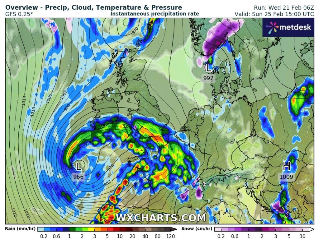
Sunday: There is a chance that a low pressure drifting across southern England reaches us. But, for now that’s not the most likely outcome. However, it will bring some high-cloud, so expect some hazy bright spells after a cold start. Hopefully a dry day but feeling cool with more in the way of a breeze compared to yesterday. Max 8°C Min 4°C

Outlook: A ridge of high pressure building in from the southwest means a couple of settled days to start the working week. Bright spells, a bit windy at times and dry. Temperatures around average but it seems we will have too much of a breeze and cloud-cover to lead to any frosts. After that, it looks set to turn unsettled once more.

Follow @ChadWeather on X for the latest forecasts and warnings.
Thanks,
Jon
Images: www.wxcharts.com
Forecast Issued: Wednesday the 21st of February 2024 at 6pm.


